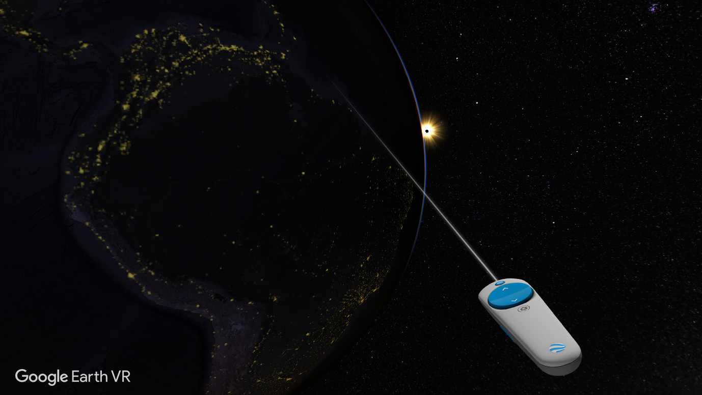
Phew! What an end to the week. Today’s commute was simply exhausting. I started hovering over Paris, and then I went to Niagara Falls. Then I went to space for a bit, and after that I passed by Kathmandu and Mount Everest. Then I stopped off at Mount Rushmore before having a layover at Monument Valley. Then I went to space again, before finishing up with a jaunt around Europe.

Google Earth VR may not be a video game, but it has a feedback loop that’s just as compelling. I only meant to dive in for a couple of hours to get a feel of the thing, and ended up losing half the day.
This makes me feel all the more foolish for ignoring it for so long. I’ve had Google Earth VR downloaded on my hard drive for ages, but I kept putting off looking at it because, well, it’s basically just a posh globe, innit? Sure, in VR the Earth might look a bit more spherical, but I stopped getting excited by spheres when I was about three years old.

As it turns out, Google Earth is much more than a fancy Atlas. It has all the functionality of regular Google Earth, letting you locate pretty much any location in the world, and zoom in through layers of satellite footage right down to street view level, assuming it has photos of the available location, which is does in 99 percent of occasions.
In addition to this, however all of its terrain and many of its key locations are rendered in Full 3-D.
Cities in particular have received a lot of attention, letting you fly around 3D models of places like Manhattan, Paris, London, and so forth. The detail on these 3D renders is truly astonishing. One of the first things I did was re-trace a route I walked through when I visited Paris early last year, crossing the Seine and passing under the Eiffel Tower before walking across to Notre Dame and the Louvre. And it looked pretty much exactly how I recall it. The models stand up impressively to close scrutiny to. I got right up in the face of those Monument Valley mesas, and you could see every crack, pillar, and cliff edge on those craggy Utah bad boys.
Not every location in Google Earth has this full 3D feature. I went to Kathmandu, for example, and that was flatter than an elephant’s piano. But the number of areas that do have this functionality is genuinely impressive. Here are some quick and entirely serious reviews of the places that I visited:
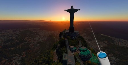
Paris – 9/10 It’s Paris mate. Big tower, big river. Big Ben. What’s not to like?
Mount Everest – 7/10 Looks a bit cold. Couldn’t find base-camp. Gotta love that Khumbu icefall though.
Niagara Falls – 5/10 Pretty but can’t see anything in the street-view pics because spray.
Mount Rushmore – 3/10 Not finished. Still in Early Access.
Ayer’s Rock – 5/10 Big but too dusty. Looks like a mountain that’s been Tango-ed.
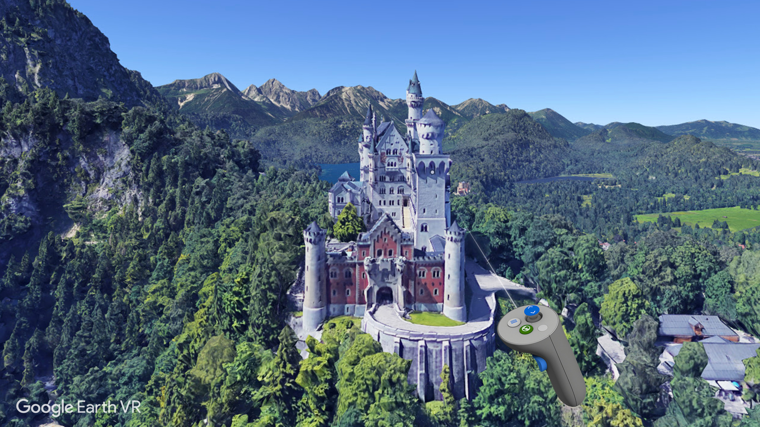
Neushwenstein Castle – 8/10 It’s the Disney castle, innit? Looks pretty but too hard to spell. Not to be confused with Wolfenstein Castle, which doesn’t exist.
Mont St Michel – 9/10 Weird-ass island monastery with awesome narrow streets. Basically Minas Tirith from Lord of the Rings, only a bit worse because it’s French..
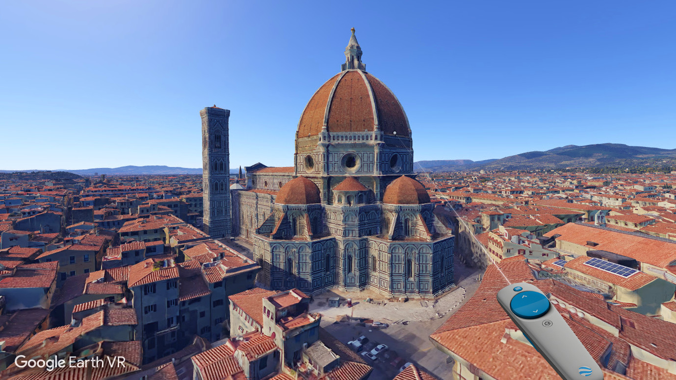
Florence – 10/10 Adore those red-tiled rooftops. Bring on that Jesper Kyd soundtrack.
Right, that used up 100 words nicely ("nicely" - ed.). Anyway, navigating around Google Earth using the Oculus Touch controls is simple enough. Google Earth visualises the controllers in front of you, and even highlights which button does what. You can zoom right out to a full-earth view and physically spin the globe around by depressing the trigger and pulling with your hand. Or, if you don’t fancy looking for places manually, which can be tricky given that your view of Earth is often at the mercy of Big Cloud, you can bring up the locations menu and select one from a pre-set list (which mainly focuses on those places with 3D rendering).
There are a couple of features that I wish Google Earth was clearer about when you start using it. First, when you move around in Google Earth, only the very centre of your vision remains a rendered image, while the rest of it fades into a wireframe. This is designed to prevent motion sickness. But Google Earth doesn’t make it clear that this is an optional feature you can switch off.
In addition, Google Earth has a “Human Scale” mode that lets you get right down to ground level when you’re flying around. If you want to get a true sense of scale with mountains and skylines and such, that’s the mode you want to be playing in. But Google Earth defaults to having this mode off, presumably to stop people getting stuck or disoriented. Again though, it doesn’t make it clear that this powerful option is available to you, which means you might play without seeing the full potential the app has to offer.

Nonetheless, I think Google Earth is a fantastic VR app, one that offers a powerful, enlightening, and genuinely different experience compared to many other VR applications. It’s also completely free to download, which makes it a great application to experiment with. I don’t know if it’s necessarily a good place to start with VR, because the scale might be quite alarming if you’re not used to using the tech. But I definitely think it should be one of your first ports of call, maybe after messing around in Valve’s The Lab.


MSI MPG Velox 100R Chassis Review
October 14 2021 | 15:04

Want to comment? Please log in.